Saturday, September 13, 2014

BALD HEAD ISLAND LIGHTHOUSE-BALD HEAD ISLAND, NORTH CAROLINA


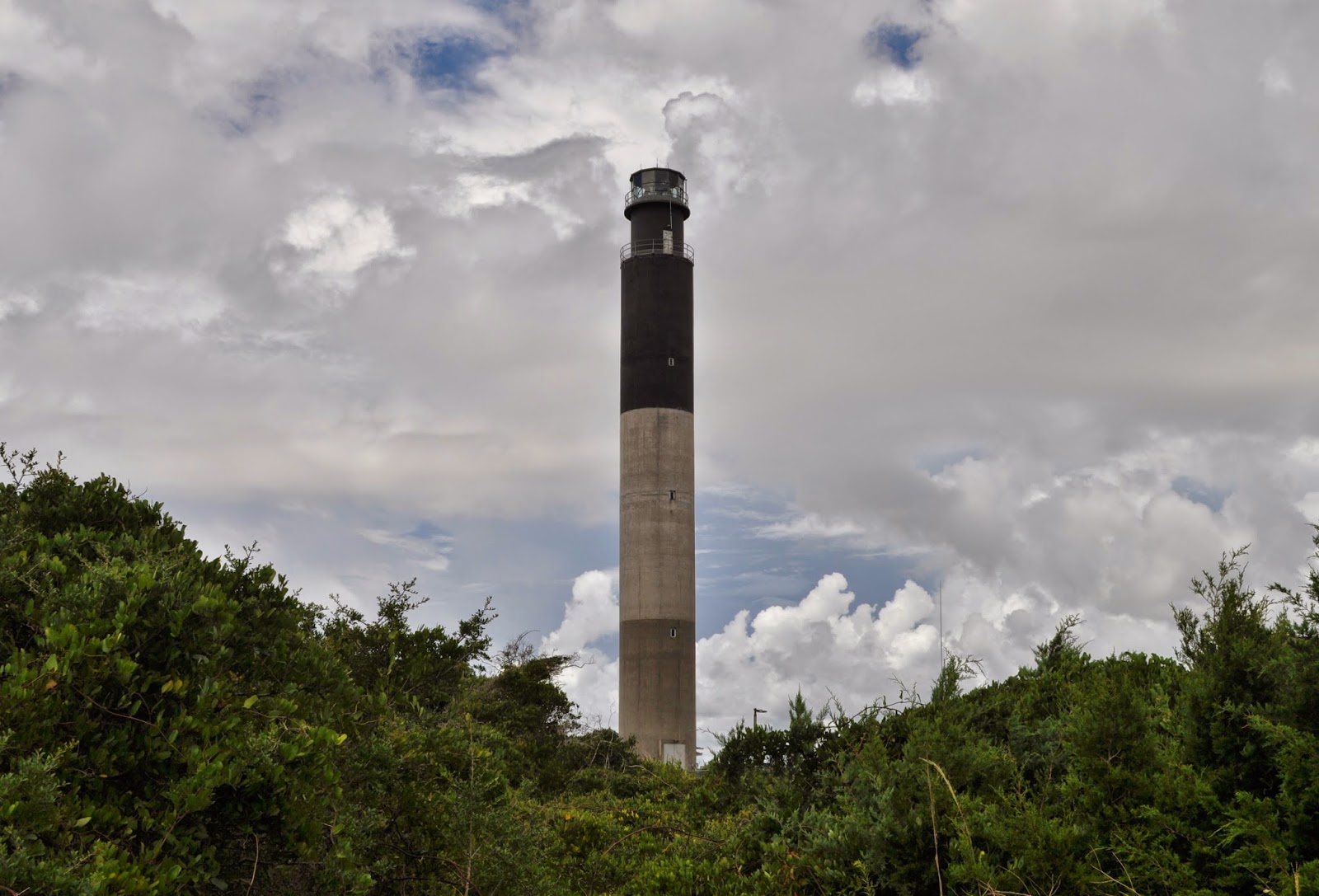
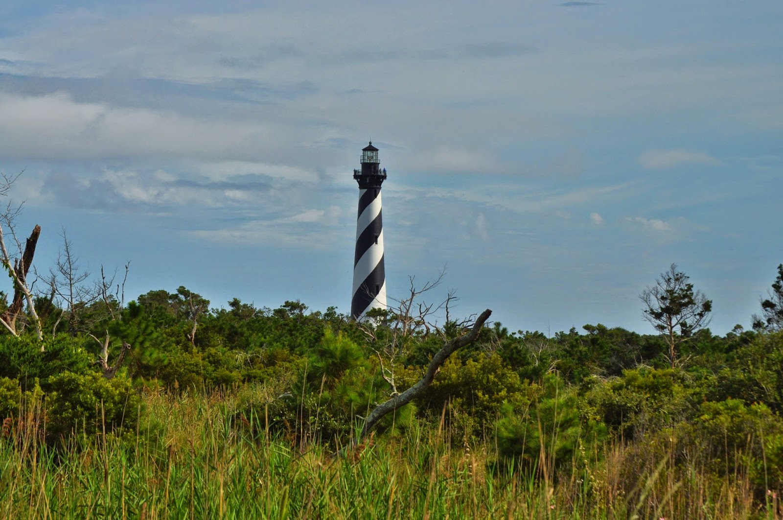
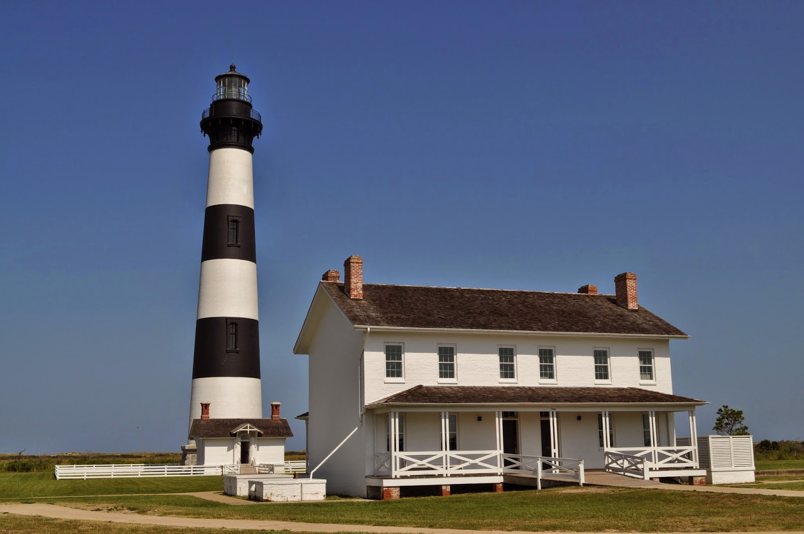
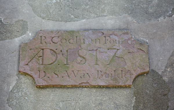
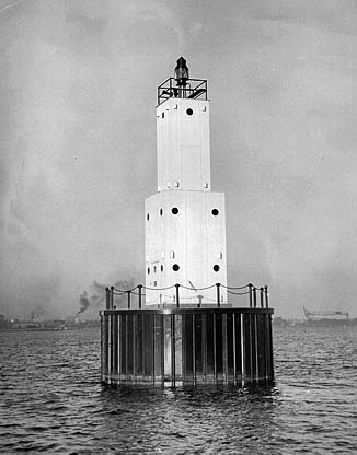
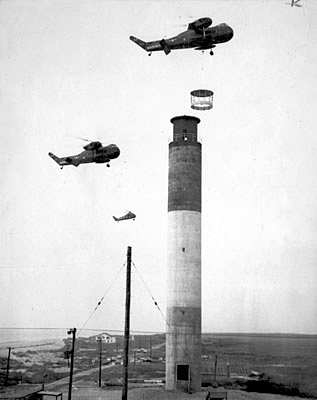
Bald Head Island is actually part of Smith Island, a collection of islands crisscrossed by creeks and inlets, and received its name from the denuded dunes on its south beach, which resemble a bald head. Extending twenty-eight miles from the southeast end of the island are Frying Pan Shoals, a collection of shifting sandbars, obscured by a thin covering of water. Early sailors dubbed the area Cape Fear, no doubt a reference to the feeling evoked when navigating near the hazardous shoals. A ten-acre site on the west side of Bald Head Island, along the banks of the Cape Fear River, was selected for North Carolina’s first lighthouse. The property was purchased from Benjamin Smith, who would later become the governor of North Carolina. In 1792, Congress appropriated $4,000 to complete the lighthouse that had been started by North Carolina before it became part of the United States. Work on the lighthouse was overseen by Abisha Woodward, who would later build two lighthouses in Connecticut: New London Harbor and Falkner's Island. Bald Head Island Lighthouse, which was first activated on December 23, 1794, directed traffic to the Cape Fear River and the growing port of Wilmington, located several miles upstream. Henry Long was hired as the first keeper of the lighthouse and served until October 1806, when he was killed by his son-in-law in a hunting accident. Twelve residents of the area signed the following petition that was sent to President Thomas Jefferson on December 31, 1806, recommending the appointment of Sedgwick Springs as keeper: We the subscribers resident Citizens in the District and town of Wilmington being informed that Sedgwick Springs wishes to become a Keeper of the Light House on Bald Head (provided it should be thought the widow of the late Henry Long, inadequate to the safe keeping thereof) beg leave Hereby to Recommend the said Sedgwick Springs as a fit and proper Person to take charge and keep up the said Light—He being an old Inhabitant of the town of Wilmington a Sober Industrious Citizen having been employed for these eight Years last past and now is an Inspector of the Revenue in which Office he has ever behaved himself as a dilligent and Carefull Officer and to our knowledge conducted himself as a truly honest man in all his dealings. Due to severe erosion along the river, the demolition of the original lighthouse was ordered in 1813, and by 1817, the replacement lighthouse, “Old Baldy,” was built farther inland and lit, for just under $16,000. A stone plaque above the entrance identifies the builder as Daniel S. Way, and the foundry for the lantern room as R. Cochran. Still the oldest in North Carolina, the octagonal brick and plaster tower stands ninety feet tall and was originally equipped with an array of lamps and reflectors. In 1849, a new lantern room was installed atop the tower and the old lighting apparatus, consisting of eighteen lamps and sixteen-inch reflectors, was replaced with fifteen brass lamps and twenty-one-inch reflectors. The lantern room is offset from the center of the tower, and as technology improved, it received a third-order Fresnel lens in 1855. At its base, the tower is thirty-six feet wide and at its top fourteen-and-a-half feet wide, while the walls are five feet thick at the base and taper to two-and-a-half feet at the top. The rectangular stairway leading up the inside of the tower is made of Carolina yellow pine. Some problems with Bald Head Lighthouse included its location and illumination. Positioned some four miles from the eastern end of the island and equipped with a minor light, the lighthouse was unsuccessful in guiding ships safely past Frying Pan Shoals. A lightship was therefore placed on the shoals and served from 1854 until 1964. Bald Head Light was discontinued in 1866 when the screwpile Federal Point Lighthouse was built eight miles upstream, near the present Fort Fisher ferry landing. After Federal Point Lighthouse was deactivated in 1879 upon the closure of New Inlet Channel by the Engineer Department, Old Baldy was returned to service along with a beacon on the nearby beach, which formed a range to help mariners safely enter the river. On March 3, 1883, the characteristic of Bald Head Lighthouse was changed from fixed white to a red flash every thirty seconds through the installation of a new fourth-order lens. Later that year, a 150-foot-long stone jetty was built to protect the tower from erosion, and this work likely saved the tower from being toppled by a hurricane that struck in September 1883. Keeper James H. Dosher reported that an earthquake shook the tower for ten seconds at 9:50 p.m. on August 31, 1886, breaking the glass chimney in the lamp. The shaking was accompanied by a hiss and and rumbling noise in the earth. On March 8, 1893, the characteristic of the light was changed from a red flash every thirty seconds to a white flash with the same period. In 1898, Congress authorized the construction of a 159-foot, skeleton tower, named Cape Fear Lighthouse, on the southeastern end of Bald Head Island, where it could mark Frying Pan Shoals. Cape Fear Lighthouse served from 1903 to 1958, when Oak Island Lighthouse, located on the mainland, became operational. After the completion of the new Cape Fear Lighthouse, Old Baldy was changed to a fourth-order fixed light and then decommissioned in 1935. Its Fresnel lens was removed from the tower, and from 1941 to 1958 the tower housed a radio beacon. The lighthouse was sold to a private owner in 1963. After another change of hands, the lighthouse was donated to the Old Baldy Foundation, organized to restore North Carolina’s eldest treasure. Restoration of Bald Head Lighthouse included placing a new cooper roof on the off-center lantern room and patching up the layer of stucco that covers the brick tower. Over the years, patchwork repairs have led to the unique mottled look of the lighthouse. Visitors can now scale the 112 restored wooden stairs to reach the top of the tower and take in the beautiful island setting. The lighthouse was relit as an unofficial aid in 1985. 

Bald Island lighthouse 1893
 

SAND POINT LIGHTHOUSE-ESCANABA, MICHIGAN


Located on Little Bay de Noc in the northwest corner of Lake Michigan, Escanaba was founded in 1862 in conjunction with the building of a railroad line linking the iron ore mines in Negaunee to Little Bay de Noc. The railroad was completed in 1865 along with a gravity-fed dock for loading the ore onto ships.   Anticipating the significance of the port at Escanaba, Congress appropriated $5,000 for a “beacon light on Sand Point” in Escanaba on July 2, 1864. A suitable site for the lighthouse was selected, but the owner of the land was unable to produce a clear title to the property, a prerequisite before construction could start. This delay gave the Lighthouse Board time to reconsider its plans for the lighthouse, and in its 1866 report it wrote: the necessity for this light is considered one of great urgency, marking, as it does, the approach to the harbor of Escanaba, a place of growing commercial importance and already one of the main shipping ports of the Lake Superior iron ore. It is recommended that the light be built in a more substantial manner than was anticipated when the appropriation was made, and with this view an estimate of an additional appropriation (seven thousand dollars) is submitted. Congress provided an additional $9,000 for the lighthouse on March 2, 1867, and with a title to the property recently obtained, work on the lighthouse was carried out during the 1867 season. The lighthouse consists of a rectangular, one-and-a-half-story keeper’s dwelling, built with yellow brick, with a square tower centered on its western end. A fourth-order Fresnel lens installed in the tower’s lantern room initially displayed a fixed white light at a focal plane of forty-four feet above the surrounding water.  John Terry was appointed  first keeper of Sand Point Lighthouse, but he passed away in April 1868, and it was actually Mary Terry, his wife, who lit the light for the first time on May 13, 1868. As she had no children, Mary kept the light alone until 1886, when she met a tragic end. Metal handrails were added to the tower’s stairs in 1901, the same year a brick oil house was built on the station’s grounds. The intensity of Sand Point Light was increased from 130 to 500 candlepower on July 1, 1913, when the illuminant was changed to electricity.  In the 1920s, the Bureau of Lighthouses requested around $70,000 to improve the light and fog signal at Escanaba, noting that the ports at Escanaba and Gladstone were some of the most important on Lake Michigan.  The planned improvements were described as follows:  It is proposed to erect a light on a pile foundation, with concrete or steel-sheet superstructure, located near the outer angle of the point, and to erect an inclosed steel-plated tower; run an electric transmission cable from shore, move the present apparatus out to this tower, and illuminate with electricity; install electric-driven air compressors, and modern fog signal in tower operated by remote control from shore, improve the present keeper’s dwelling, and construct a new dwelling for the assistant keeper. The request for funds were repeated numerous times, but work on the structure did not begin until August 5, 1938. The work was done by the Ludke Construction Company, and the Annual Report of the Lake Carriers’ Association gave the following description of the new light:
This light is located in 8 feet of water on the sandy shoal called Sand Point in Green Bay and consists of a circular black cylinder of interlocking steel sheet piling filled with stone and capped with a slab of concrete. On the pier thus provided is erected a square steel tower painted white. The tower is surmounted by a 275 m.m. lantern equipped with an electric light showing an occulting white light, 2 seconds eclipse, 4 seconds in duration, of 2,700 c.p. The base of the tower houses a motor-driven compressor supplying air to the diaphragm horn fog signal which sounds a blast of 2 seconds duration every 20 seconds. The signals are controlled by submarine cable from shore. The old lighthouse was greatly modified to provide improved housing. The lantern room and top ten feet of the tower were removed along with the spiral staircase. The roof of the dwelling was raised four feet to provide space for three bedrooms and a bath on the second floor. Additional windows were cut in the outer walls, and the configuration of the interior walls was modified. The Coast Guard later added aluminum siding to the exterior, further hiding any evidence that the structure had once been a lighthouse. When the Coast Guard announced its plans to abandon and possible raze the dwelling in 1985, the Delta County Historical Society stepped in to save one of the most historic buildings in the area. Using a copy of the original plans, the society began work to restore the original appearance of the lighthouse. The tower was rebuilt, the walls in the upper story were lowered, and a cast-iron lantern room was obtained from Poverty Island Lighthouse. To complete the restoration, a fourth-order Fresnel lens used in the 1927 Menominee Pier Light was installed in the tower. The interior rooms have been furnished to resemble the period when Lewis Rose served as keeper. After five years of restorative work, the lighthouse opened to the public in 1990. Ownership of the lighthouse was transferred to the society in 1998. 

Escanaba Light that replaced Sand Point Lighthouse
Photograph courtesy U.S. Coast Guard


OAK ISLAND LIGHTHOUSE-OAK ISLAND, NORTH CAROLINA


The entrance to Cape Fear River is bounded by Bald Head Island on the east and Oak Island on the west. North Carolina's first lighthouse was completed on Bald Head Island in 1794 to mark the entrance, but due to erosion, it had to be replaced in 1817 by the current Bald Head Lighthouse, built a mile farther inland.  Oak Island Lighthouse is an intriguing mixture of old and new, tradition and innovation. The present structure, completed in 1958, is one of the most recent lighthouses built on American shores. Although the current lighthouse is young, attempts to illuminate this particular stretch of water have been made for over two hundred years. These efforts have been thwarted by hurricanes, war, and changing shipping channels. In 1903, the Lighthouse Board built the 150-foot-tall Cape Fear Lighthouse a few miles west of Bald Head Lighthouse. Outfitted with a first-order Fresnel lens, the lighthouse produced a powerful flashing light to warn mariners away from the dangerous Frying Pan Shoals. Cape Fear Lighthouse served as the area’s coastal light until 1958, when an even more powerful light was installed atop a new tower constructed on Oak Island. As the last lighthouse built in North Carolina, Oak Island Lighthouse is as durable as they come. Twenty-four concrete-filled pilings were driven sixty-seven feet into the ground to provide a solid foundation, and an octagonal concrete base, measuring thirty feet wide and three feet deep, was used to cap the pilings. The tower itself stands 158 feet tall and is made of solid, eight-inch-thick, reinforced concrete. During construction of the tower, a temporary concrete mixing plant was set up at the site and operated continuously for six days. The concrete was poured into a movable form that was slowly raised by jacks at the rate of one foot per hour. When the project was submitted for bids, a tapering tower built of experimental aluminum-alloy panels was one of two potential designs, but the concrete tower with a constant diameter of seventeen feet won out.The three bands of color that give the tower its distinctive daymark also speak of modern innovation and durability. For the first forty feet of the tower, workers poured natural gray cement. In forming the next fifty feet they used a mixture of white Portland cement and white quartz aggregate, and for the final fifty feet they mixed black coloring with the cement. The result is a monolithic tower with three bands that never need repainting.Unlike traditional lighthouses, Oak Island Lighthouse has no spiral staircase. Instead, its keeper had to climb a series of ships ladders with a total of 134 steps. Tools are hauled to the top in a metal box attached to a long pulley. The aluminum lantern room, which now houses four 1000-watt aerobeam lights, weighs 1,740 pounds and had to be installed by a Marine Corps helicopter. With its 2.5 million candlepower lights flashing intermittently and visible twenty-four miles out to sea, Oak Island Light is one of the most powerful lighthouses in existence. On May 15, 1958, eighty-five-year-old Captain Charles N. Swan, who was born at Amelia Island Lighthouse, served aboard Frying Pan Shoals Lightship, and was keeper of Cape Fear Lighthouse on Bald Head Island from 1903 to 1933, threw the switch to activate Oak Island Lighthouse. Twenty minutes after its activation, the light went out, but a fuse was quickly replaced, and the beacon was back in operation before darkness fell.In the 1930s, the U.S. Coast Guard took ownership of the land on which Oak Island Lighthouse is located and used a portion of the property for a Coast Guard station. However, in 2004, both the Oak Island Lighthouse and the land immediately surrounding the tower were deeded to the town of Caswell Beach. A non-profit organization, Friends of Oak Island Lighthouse, has been formed to preserve and maintain the lighthouse and grounds. The Coast Guard still is in charge of maintaining the lights, but the public is able to climb the lighthouse through tours arranged through Friends of Oak Island Lighthouse. If that sounds like too much work, the town has constructed a boardwalk and an observation deck just across the street that provide a great view of the lighthouse. 

                                                                                        Oak Island Lighthouse in 1962
                                                                                 Photograph courtesy U.S. Coast Guard
 Photograph courtesy State Archives of North Carolina

Thursday, September 11, 2014

MANISTIQUE EAST BREAKWATER LIGHTHOUSE-MANISTIQUE, MICHIGAN


In 1892, lighthouses were completed at Seul Choix Point and on Squaw Island to mark the northern route for vessels sailing between Lake Huron and Green Bay. The Lighthouse Board felt that another light was needed to mark this important passage, and provided the following reasoning in its request for $32,000 for the project. The establishment of the Lake Michigan light and fog-signal vessels, Squaw Island light and fog signal, Seul Choix Pointe light, and the additional buoyage authorized in the northern part of Lake Michigan has made those waters reasonably safe for navigation on the route from the Straits of Mackinac to Green Bay ports, with the exception of a stretch of 45 miles between Seul Choix Pointe and Poverty Island. Pointe aux Barques is a prominent headland 24 ½ miles northeast one-half north from Poverty Island light, and 23 miles west-southwest from Seul Choix Pointe light. Poverty Island light is visible 16 3/4 miles and Seul Choix Pointe is visible 15 miles. There is, therefore, a spate of 13 3/4 miles off Pointe aux Barques not covered by any light. The town of Manistique, situated at the mouth of Manistique River, at the head of the bay between Seul Choix and Pointe aux Barques, has a large lumber trade and many vessels call at that port. The route north of the Beavers and along the coast down to Poverty Island passage into Green Bay is the usual route of the ore vessels to and from Lake Erie ports in northwest winds, and the shipments of ore this year from Escanaba are largely in excess, it is said, of those of any port in the world. The Board recommends that a coast light and fog signal be established on Pointe aux Barques, Lake Michigan, Michigan. The Garden Peninsula extends twenty-two miles into Lake Michigan from Manistique and is bordered by Lake Michigan on its east and Big Bay de Noc on the west. Poverty Island Lighthouse is located off the peninsula’s southern tip, and Point aux Barques is a prominent feature on the peninsula’s eastern shore. Though the construction of the lighthouse on Point aux Barques was authorized, funds for its construction were never provided.  A lighthouse was finally built in the gap between Poverty Island and Seul Choix Point, but this did not occur until after federal harbor improvements were completed at Manistique. A 423-foot-long breakwater built by private parties and owned by the Chicago Lumbering Company helped protect the harbor at Manistique, but this was turned over to the federal government, and between 1910 and 1915, two breakwaters were built at the mouth of the river, forming an enclosed basin with an area of thirty-one acres. In the early 1900s, car ferries began operating out of Manistique, linking its railroad to the ports at Northport and Frankfort on the Lower Peninsula. A temporary fixed red light of forty-five candlepower was suspended from a pole to mark the west end of the newly completed east breakwater in 1912, and that same year the Lighthouse Board asked for $20,000 for a permanent light, fog signal, and keepers dwelling. Congress provided the requested amount on October 22, 1913, allowing work to being the following year. A twenty-five-foot, steel, skeletal tower, surmounted by a flashing acetylene light, was established on the west breakwater on October 30, 1914. Also in 1914, a concrete foundation was poured for the permanent east breakwater light, and work began on the keepers dwelling. The east breakwater light was transferred to the new structure on August 17, 1916. The following description of this light, known as Manistique Lighthouse, was published by the Bureau of Lighthouses. The subfoundation for this tower consists of a timber crib built by the United States Engineers. It rests on bedrock and supports a concrete superstructure, and this in turn supports a rectangular concrete block, 20 by 25 feet in plan and 6 feet high, forming the immediate foundation for the tower. The top of this block is 10 feet above lake level. The tower is of riveted steel plates and angles, square in plan and pyramidal in shape, three and one-half stories high, and supports a cast-iron deck and an old-style fourth-order vertical bar lantern, whose focal plane is about 40 feet above the top of the block. The main floor is 5 1/2 feet above the block and contains the machinery for the fog signal. Below it and partly within the block is a basement room for storage purposes. Above it the second floor supports the air tanks and the third floor the diaphone and attachments. All floors are of reinforced concrete, and the basement and power room are lined with surfaced cement with air spaces next to the steel plates. The two upper rooms are not lined. A 300-millimeter lens lantern was used to produce a fixed red light of 340 candlepower at a focal plane of five feet above the lake. A 200-watt, gas-filled, tungsten-filament electric bulb, powered by an electric cable that along the breakwater to the lighthouse from a switch house, was used in the lens lantern and could be activated from the keepers dwelling using a push-button. A fourth-order lens replaced the lens lantern in 1918, increasing the intensity of the light. A radiobeacon was established at the station at the opening of navigation in 1931 as an additional aid for mariners. Both the railroad and its car ferry at Manistique ceased operation in 1968, and with the decrease in shipping, Manistique Lighthouse was automated the following year. The keepers dwelling was sold, and the fourth-order lens was removed from the tower. The lens can currently be seen at the Wisconsin Maritime Museum in Manitowoc.

SOUTH BASS ISLAND LIGHTHOUSE-SOUTH BASS ISLAND, OHIO


With the South Passage now acting as the primary navigational route not just for commercial vessels but for passenger and leisure boats as well, there was growing concern about the safety of the waterway. Rocky reefs lay hidden in the shallow waters, and sailing through the area could prove treacherous in the late fall when sudden storms could wreak havoc on Lake Erie. The United States Lighthouse Board requested $8,600 for a lighthouse on South Bass Island in 1890, but the requested amount was not appropriated until August 18, 1894. This wasn't the first time money had been set aside for a lighthouse on the island. When Lieutenant Charles T. Platt was examining lighthouses and proposed lighthouse sites on Lake Erie in 1838, he noted that an appropriation of $3,000 had been made for a lighthouse on South Bass Island. To his surprise, the lighthouse was to be placed on the northwest tip of the island instead of the southwest corner where Platt and others thought it should be. So sure was Platt of the superiority of the southern location that he surveyed the island's southwest cape and carved the letters "LH" into a tree to indicate where the lighthouse should be erected. A lighthouse was established on nearby Green Island in 1855, but South Bass Island would have to wait a few more decades to receive its lighthouse. The federal government purchased two acres at Parker’s Point, the extreme southwest tip of the island, from Alfred and Mary Parker in May 1895 for $1,000. A contract was made in 1896 for constructing the lighthouse, but the winning bidder failed to execute the required bond, and the work had to be readvertised. All of the bids received in the second round exceeded the available funds so the work was performed by hired labor with materials purchased on the open market. Unlike the day's typical design of a large lighthouse with a small, detached keepers dwelling, South Bass Island Lighthouse consisted of a large, two-and-a-half-story, redbrick dwelling with an attached, twelve-foot-square tower. The tower stood forty-five feet tall when finished and was crowned with a fourth-order, L. Sautter & Cie., Fresnel lens that produced a fixed red light through the use of a ruby chimney in its lamp.  South Bass Island Lighthouse was lit for the first time on July 10, 1897, by Keeper Harry H. Riley. Under his care, the lighthouse would perform its duty daily during the shipping season, which typically ran from early March through late December. Riley's time on the island was cut short, however, when on September 1, 1898, he was taken into custody by Sandusky police because of problems associated with his mental health. Keeper Riley was convinced he owned a fast racehorse and was inviting everyone to the fairgrounds to see the horse go for a record. Riley passed away the following March at a state hospital. Mrs. Riley took charge of the lighthouse during her husband's illness. Keeper Charles B. Duggan arrived at the lighthouse in 1908, after having served five years at West Sister Island. Besides caring for the light, Duggan also cultivated twenty acres of land. A vineyard occupied eight acres, and the rest was devoted to a peach orchard and general farming. In 1915, he helped a crew of eight from the burning steam barge Isabel Joyce land at the station and then and cared for them. Keeper Duggan fell to his death from a forty-five-foot cliff on the western end of the island in April 1925. Twenty-year-old Lyle Duggan cared for the light in place of his father until the following year, when Green Island Lighthouse was automated, and its keeper, William F. Gordon, was transferred to South Bass Island Lighthouse.  The characteristic of South Bass Island Lighthouse was changed at the opening of navigation in 1926 to alternating red and white flashes, the former characteristic of Green Island Light. On September 7, 1929, the intensity of the light was great increased through the installation of electricity as the illuminant. The white flash went from 1,800 candlepower to 32,000, while the red flash increased from 540 to 9,600. A total of eleven keepers served at the lighthouse, the last being Paul F. Prochnow, who departed the island in 1962 after fifteen years of service. Keeper Prochnow's lightkeeping career almost ended prematurely in 1959, when his Model A Ford went through the ice near Green Island. Prochnow and a friend had to swim thirty feet to the surface from where the car ended up "parked" on the bottom of Lake Erie. By the time Prochnow's days as keeper on South Bass Island were drawing to a close, technology had changed dramatically. When he retired, the living quarters were put up for rent, and the Coast Guard replaced the lighthouse with an automated electronic light mounted atop a steel tower. With the automation, the Fresnel lens became a piece of the island's past and was placed in the Lake Erie Island Historical Museum, where it can still be viewed today.

CAPE LOOKOUT LIGHTHOUSE-CAPE LOOKOUT, NORTH CAROLINA


It’s fitting that one of the most strikingly distinctive lighthouses on the eastern seaboard is on a stretch of the Outer Banks that has witnessed everything from hurricanes to malaria, from pirates to Nazi U-boats. To paraphrase Thomas Gray, Cape Lookout has “read a nation’s history in its eye.” The twenty-one-mile stretch of Cape Lookout Shoals has a history as long and interesting as its country’s. The land has been inhabited for centuries; in 1524, the Florentine explorer Giovanni da Verrazano reported native peoples living in the area, and between 1540 and 1570 Spain sent several explorers to the region, although none attempted to colonize. It wasn’t until English settlers came that the Old World got its foot firmly in the door of this part of the New World. North Carolina saw the first attempts at English colonization in 1585, and by 1650 hundreds of settlers had moved south from Virginia. At that time, the region was under control of the Lord Proprietors — complete with a constitution drafted by John Locke — until 1729, when North Carolina became a royal colony. But on April 12, 1776, North Carolina became the first colony to call for independence from England. Meanwhile, the surrounding waters had seen their share of excitement. The convoluted and protected coast around Cape Lookout and Ocracoke provided ideal locations for pirates to launch attacks against other ships and to hide with their captured booty. Lookout Bight was a favorite refuge for colonial sailors seeking safe harbor during the frequent hurricanes and storms, but the most lasting activity came from the ever-increasing maritime commerce along the eastern seaboard.  Because of opposing currents, the Outer Banks proved tricky to navigate. Vessels sailing south needed to keep close to land to avoid the northbound waters of the Gulf Stream, and vessels sailing north needed to stay in the Gulf Stream to avoid the southbound Labrador Current. However, all vessels had a common problem: the warm Gulf Stream mixed with the cool Labrador Current to produce intense fog and dangerous shoals. The particularly treacherous area off Cape Lookout earned the name the “Horrible Headland.” In 1803, Congress appropriated $5,000 for a committee to evaluate the possibility of building lighthouses along the eastern seaboard. The long-term plan was to build lights along the Outer Banks approximately forty miles apart, so that as soon as ships lost sight of one light, the next would come into view. In 1804, Congress authorized a lighthouse at Cape Lookout, and in February, 1805, a four-acre plot of land was deeded to the government by Joseph Fulford and Elijah Piggot. Getting construction for the lighthouse underway took some time, though, and it wasn’t until 1812 that the first Cape Lookout Lighthouse was completed at a cost of $20,678.54. Built on a sand dune, the ninety-six-foot brick tower was encircled by a octagonal wooden tower covered in cedar shingles and painted with wide, horizontal red and white stripes. Winslow Lewis stated in 1817 that the tower's stripes made it appear “at a distance like a ship of war with her sails clewed up, and was often taken for such during the later war.” The first keeper, James Fulford, whose parents had provided the land for the lighthouse, was appointed by President James Madison and paid an annual salary of $300. Sadly, it was immediately apparent that the much-anticipated light was a busted flush. Thirteen oil lamps produced a fixed white light that was supposed to be visible sixteen to eighteen miles out to sea, but in actuality was visible only eleven miles in good weather, and less than that in bad. Because the tower was too low to be effective, mariners griped that seeking the light was more dangerous than braving the shoals. The captain of the mail steamer Illinois, Lieutenant H.J. Hartstene, complained that “…the lights on Hatteras, Lookout and Cape Florida, if not improved had be better dispensed with as the navigator is apt to run ashore looking for them.” By 1850 the lighthouse was in serious disrepair, and the keeper had to constantly shovel piles of sand that would build up against his quarters. Additionally, the coast had eroded enough that the ocean was now dangerously close to the light. A first-order Fresnel lens was installed in 1856, but it wasn’t until March 3, 1857 that Congress appropriated $45,000 to build a new lighthouse. First lit on November 1, 1859 by Keeper John Royal, the second Cape Lookout Lighthouse proved to be a model for the other lighthouses that would be rebuilt along the Outer Banks—Cape Hatteras, Bodie Island, and Currituck Lighthouses. Standing 163 feet tall, the graceful new tower was just over twenty-eight feet in diameter at its base with nine-foot thick walls. It was made of red brick and displayed the Fresnel lens from the old tower. At the new height, the fixed white light was visible for nineteen miles and could easily be seen above the almost opaque salt spray whipped up by fierce winds. The old tower remained standing for several years and was converted into a residence. The new tower was not destined to be in peaceful service for long, however. Just eighteen months after its completion, North Carolina joined the Confederacy. As Union forces advanced on the Carolina coast, Confederate troops dynamited Bodie Island Lighthouse and dismantled the Cape Hatteras light. In the spring of 1862, retreating Confederate troops attempted to blow up Cape Lookout. They were unsuccessful, but they did manage to damage the tower. The lens had been removed from the tower the previous year and was eventually take to Raleigh. A third-order lens was placed in the lantern room and the light was returned to service in 1863.  On April 3, 1864, a small band of Confederates, armed with powder kegs, launched a raid to destroy Cape Lookout Lighthouse. They were again unsuccessful but did manage to badly damage the lower portion of the iron spiral stairway and destroy the oil supply. Wooden steps were used to replace the damaged portion of the stairway. After the war, the Lighthouse Board lost no time repairing the damages. Congress authorized $20,000 for Cape Lookout Lighthouse in 1866, and the next year, the temporary wooden stairs were replaced with cast iron, and the first-order lens, “much injured by the rebels” was restored to its place. The lens had been sent to its manufacturer in France for repairs in 1865.   In 1871, Congress appropriated $5,000 for a new keeper’s dwelling, complete with summer kitchen and woodshed, as the old residence was in danger of being destroyed in stormy weather, leaving the keepers without any shelter on the desolate coast. The year 1873 was a big one for Cape Lookout Lighthouse. The keeper’s cottage—large enough to house two assistant keepers and their families—was completed, and the tower was painted. Because the four tall towers on the Outer Banks were so similar, the Lighthouse Board designed striking patterns for each to make them easily distinguishable. Cape Lookout was painted with large, diagonal checkers that appear as alternating black and white diamonds. Following the traditional daymark aids to navigation, the black diamonds are orientated north and south toward the shallow waters of the shoals and around the headlands, while the white diamonds are orientated east and west facing the deeper waters of Raleigh’s Bay to the east and Onslow Bay to the west. The next few decades proved relatively uneventful, with only minor changes to the lighthouse. The price of whale oil became prohibitive, so in 1885 the lamps at Cape Lookout alternated between whale oil and kerosene, changing to only kerosene in 1907. Also, that year saw the addition of a head keepers quarters, built for $4,479. In the years prior to this, the keeper and his two assistants had been sharing the 1873 dwelling, which made it impossible for their families to life with them. The Lighthouse Board started requesting funds in 1900 to remove this hardship, but Congress took a few years to provide the money. In 1904, a lightship was stationed off the coast to provide additional help for mariners, and in 1914 Cape Lookout’s light was changed from fixed to flashing, through the installation of a three-mantle oil-vapor lamp with occulting screens. By 1916, war had again come within sight of Cape Lookout, as German submarines began plying the Atlantic. Cape Lookout became subject to “brown outs” in an effort to avoid helping the enemy. Two gasoline engines connected to electric generators were added to the station in 1933 to power a radiobeacon, whose antenna was suspended between the lighthouse and an eighty-foot steel tower located 210 feet away. At the same time, the incandescent oil vapor light used in the lighthouse was replaced by four 250-watt lamps, which increased the light's candlepower from 77,000 to 160,000.   The submarine threat of WWI would prove to be child’s play compared with what lay ahead. In the early days of WWII, Germany instigated a secret plan, named Operation “Paukenschlag” (drumbeat), for a massive submarine attack against the eastern seaboard. By the beginning of 1942, “wolf packs” of German U-boats prowled the Carolina coast looking for easy prey. Sadly, they found it in the merchant-rich waters guarded by woefully ill-prepared Navy patrol vessels. Between January and April of 1942, German U-boats sank over eighty ships off the coast of North Carolina. This time, neither any of the lighthouses nor any of the offshore lighted buoys had been darkened, causing German sub commanders to dub the exercise the “Atlantic Turkey Shoot.” The 5th Naval District, part of which included the waters off Cape Lookout, was protected by the Coast Guard vessel Dione, a cutter that had been built during Prohibition to combat rum-runners. Although perfectly suited for the Coast Guard, the vessel was no match for the U-boats. Dire warnings as well as offers of help came from the British allies, who had developed successful convoy tactics and had broken the German code, but, inexplicably, America initially ignored them. The area off the North Carolina coast became known as “Torpedo Junction” as the casualties mounted. At one point, a tanker burned in Lookout Bight for three weeks. By the end of 1942, the U.S. Navy responded in earnest. They deployed anti-submarine vessels, adopted the British convoy tactics, and initiated aircraft patrols. The U-boats’ marauding days were over, but not before hundreds of sailors had joined those already buried in the Graveyard of the Atlantic. The peaceful days of 1950 changed Cape Lookout Lighthouse forever. After the station was connected to commercial power, the light was completely automated, eliminating the need for resident keepers. The head keeper’s cottage was subsequently sold to Dr. Graham Barden, Jr., who moved it down the island in February 1958, while the 1873 dwelling was abandoned. The Fresnel lens was removed from the tower in 1975 and replaced by two aero-beacons. After being displayed at a Coast Guard facility in Portsmouth, Virginia for several years, the lens was installed in Block Island Southeast Lighthouse in 1994. Beginning in 1979 and continuing through the 1990s, dredging operations have helped to stave off erosion from the tidal currents in Bardens Inlet. On nearby Shakleford Banks, wild ponies, said to be the descendants of those brought by Spanish explorers, still roam freely. Friends of Cape Lookout National Seashore was formed in 2008 to partner with the National Park Service in preserving and interpreting the seashore. One of their first goals was to rehabilitate the lighthouse, which has been owned by the park service since 2003, so it could be regularly opened to the public. A celebration recognizing the 150th anniversary of the lighthouse began October 10, 2009. Over the following three weeks, two 1,000-watt spotlights illuminated the tower each night from sunset until 11 p.m. Various activities were held during the celebration including an art contest and events to recognize members of the U.S. Lighthouse Service, U.S. Lifesaving Service, and U.S. Coast Guard who once served at Cape Lookout. On Sunday, November 1, the anniversary of the lighting, the lighthouse was ceremonially relit after having been extinguished for one day. Perhaps the most important event during the celebration was the announcement by the U.S. Department of Interior that Cape Lookout Lighthouse would receive $487,000 for repairs needed to reopen the tower, which had been closed to visitors since an inspection in 2008 found the structure unsafe. The repair work included stabilizing the spiral iron staircase that corkscrews up the lighthouse, adding a new handrail, improving accessibility to the lantern room, and installing a new guardrail around the outside gallery. The tower reopened for climbing on July 15, 2010.  Cape Lookout at 169 feet is the 5th tallest lighthouse in the United States.
                                                                                             1899

Tuesday, September 9, 2014

OCRACOKE LIGHTHOUSE-OCRACOKE ISLAND, NORTH CAROLINA


Ocracoke Lighthouse’s modest height (seventy-five feet), subdued color scheme (solid white), and tranquil setting (a small island on the east side of Ocracoke Inlet) belie the dramatic history of its surrounding area. The calm waterway that today carries pleasure boats and small fishing craft witnessed its share of treachery, heroism, and adventure long before the lighthouse stood sentinel over the inlet.  Ocracoke hardly had an auspicious beginning; it was put on the map after an English sailing ship was wrecked on the shoal-ridden inlet in 1585. But its eventual useful role as a waterway access to various inland ports pales in comparison to the high drama played out in its waters. True, the gifted and dashing Sir Walter Raleigh landed on Ocracoke at least once during his explorations of the new world, but the real excitement came from another reckless Englishman — Edward Teach, better known as Blackbeard, the most ruthless and dreaded of pirates. By 1718, Blackbeard had come to regard Ocracoke as his favorite anchorage. He even reportedly had a house on the island, which he intended to use as a sort of pirate haven. The coastal citizens, understandably unenthusiastic about the prospect, bypassed their useless Governor Eden and appealed instead to Governor Spotswood of Virginia. Help came in the doughty figure of Lieutenant Robert Maynard of the Royal Navy, who brought with him two small sloops. An intriguing, though probably unreliable, legend claims that Blackbeard, knowing the sloops were nearby and eager to engage them in battle, spent the night before the fight impatiently crying out “O crow, cock! O crow, cock!,” which is how the inlet got its name. Though accounts vary as to how the battle started, all agree on its outcome. One of Maynard’s sloops ran aground, and Blackbeard gained on the Ranger, the sloop Maynard was aboard. Under heavy fire and unable to either return fire or escape, Maynard ordered his troops below deck. Blackbeard personally led the charge aboard what appeared to be a foundering and deserted ship, only to meet Maynard and his pistol face to face. Blackbeard attacked, but not before being grazed by the pistol and suffering a deep wound to his neck. The fight raged, with Blackbeard suffering more than thirty major wounds. Finally, Maynard prevailed, and as Blackbeard fell dead at his feet, the Royal Navy Lieutenant cut off the pirate’s head and fixed it on the bowsprit. Blackbeard’s headless body was flung overboard, where it reportedly swam around the Ranger three times before sinking to its doom. After the pirating subsided, trade increased. As inland ports such as New Bern, Elizabeth City, and Edenton grew, the need for a lighthouse to help mariners navigate the passage between Ocracoke and Portsmouth Islands that led to these towns grew accordingly. In 1798, a wooden pyramid-shaped tower was completed on Shell Castle Island, situated in the middle of the passage. However, the light was inadequate, and the sand bars changed so much that by 1818 the lighthouse was a mile away from the inlet. In a rather dramatic ending, both the lighthouse and the keeper’s cottage were consumed in 1818 by a fire started by a lightning strike.   On May 7, 1822, Congress set aside $20,000 for a lighthouse on Ocracoke Island, and the federal government shortly thereafter purchased two acres and commissioned Noah Porter of Massachusetts to build a tower and keeper’s cottage. The lighthouse was to be coated with an unlikely formula of lime, salt, ground rice, whiting, and clear glue, which was mixed with boiling water and applied to the bricks while hot. Porter completed the project the next year, for $11,359, considerably less than the sum the government had budgeted. Such happy efficiency turned out to be indicative of the useful, relatively uneventful life of Ocracoke Lighthouse. In 1849, the lighthouse was equipped with a new lantern room and lighting apparatus, which consisted of ten brass lamps and twenty-one-inch reflectors instead of the fifteen that had been used before. The apparatus revolved every two minutes to produce a flashing light. The characteristic of the light was changed to fixed white in 1854 through the installation of a fourth-order Fresnel lens.  The lighthouse survived the Civil War with minimal damage; Confederate troops dismantled the fourth-order Fresnel lens in 1862, but Union forces re-installed it the following year. The light was electrified in the early 1900s and today casts a stationary beam visible for fourteen miles. Ocracoke Lighthouse was switched off in November 2009 and remained dark until March 3, 2010 while new glass was installed in the lantern room, metalwork was repaired, and lightning protection was installed. This was the first major work performed on the lighthouse after it had been transferred from the Coast Guard to the National Park Service in 1999.

Sunday, September 7, 2014

CAPE HATTERAS LIGHTHOUSE-HATTERAS ISLAND, NORTH CAROLINA


At the behest of mariners and officers of the U.S. Navy, Congress appropriated $80,000 to the United States Lighthouse Board to construct a new beacon at Cape Hatteras in 1868. The Light-House Board was a federal agency under the direction of the Treasury Department but was headed by a multi-agency committee. The Board consisted of two Army Engineers, two Navy officers, two civilian scientists, and one additional officer from both the Army and Navy to serve as secretaries. Congress established the Board in 1852 for the purpose of creating a unified, continuous system of navigational aides along the coasts. Prior to 1852, lighthouse construction generally rested with local authorities, ultimately leading to a disjointed, ineffective national system. Under the Light-House Board, Navy officers determined where new lighthouses were needed; Army Engineers selected exact locations, designed, and built them; and civilian scientists developed new technologies and techniques for displaying bright, consistent beacons. Completed in just under two years under the direction of Brever Brigadier General  J. H. Simpson of the U.S. Army Corps of Engineers, the new Cape Hatteras lighthouse cost $167,000. The new tower, from which the first-order light was first exhibited December 16, 1871, was the tallest brick lighthouse tower in the world. It was 200 feet (61 m) above ground and the focal height of the light was 192 feet (59 m) above water. The old tower "being no longer of any use and in danger of falling during some heavy storm" was demolished in February 1872. In the spring of 1879 the tower was struck by lightning. Cracks subsequently appeared in the masonry walls, which was remedied by placing a metal rod to connect the iron work of the tower with an iron disk sunk in the ground. In 1912 the candlepower of the light was increased from 27,000 to 80,000. The Civilian Conservation Corps and Works Progress Administration erected a series of wooden revetments which checked the wash that was carrying away the beach. In 1942 the Coast Guard resumed its control over the tower, and manned it as a lookout station until 1945. The old tower was now 500 to 900 feet (270 m) inland from the sea and again tenable as a site for the light, which was placed in commission January 23, 1950. The new light consisted of a 36-inch (0.91 m) aviation-type rotating beacon of 250,000 candlepower, visible 20 miles (32 km), and flashing white every 7.5 seconds. The skeleton steel tower was retained to guard against the time that the brick tower may again be endangered by erosion and thus require that the light again be moved. The light displays a highly visible black and white diagonal Daymark paint job. It shares similar markings with the St. Augustine Light. Another lighthouse, with helical markings—red and white 'candy cane stripe'-- is the White Shoal Light (Michigan), which is the only true 'barber pole' lighthouse in the United States. Its distinctive "barber pole" paint job is consistent with other North Carolina black-and-white lighthouses, "each with their own pattern to help sailors identify lighthouses during daylight hours." The National Park Service acquired ownership of the lighthouse when it was abandoned in 1935. In 1950, when the structure was again found safe for use, new lighting equipment was installed. Now the Coast Guard owns and operates the navigational equipment, while the National Park Service maintains the tower as a historic structure. The Hatteras Island Visitor Center, formerly the Double Keepers Quarters located next to the lighthouse, elaborates on the Cape Hatteras story and the lifestyle on the Outer Banks. Cape Hatteras Lighthouse, tallest in the United States, stands 208 feet (63 m) from the bottom of the foundation to the peak of the roof. To reach the light, which shines 191 feet (58 m) above mean high-water mark, requires climbing 268 steps.  In 1999, the Cape Hatteras lighthouse had to be moved from its original location at the edge of the ocean to safer ground 1,500 feet (460 m) inland. Due to erosion of the shore, the lighthouse was just 15 feet (4.6 m) from the ocean’s edge and was in imminent danger. International Chimney Corp. of Buffalo, New York was awarded the contract to move the lighthouse, assisted, among other contractors, by Expert House Movers. The move was controversial at the time with speculation that the structure would not survive the move, resulting in lawsuits that were later dismissed. Despite some opposition, work progressed and the move was completed on September 14, 1999. The Cape Hatteras Light House Station Relocation Project became known as “The Move of the Millennium.” General contractor International Chimney and Expert House Movers won the 40th Annual Outstanding Civil Engineering Achievement Award from the American Society of Civil Engineers in 1999. The prestigious Outstanding Projects and Leaders (OPAL) Award recognizes and honors outstanding civil engineering leaders whose lifetime accomplishments and achievements have made significant difference. The Cape Hatteras Lighthouse is the tallest masonry structure ever moved (200 feet tall and weighing 5,000 tons).

BODIE ISLAND LIGHTHOUSE-OUTER BANKS, NORTH CAROLNA


  Bodie is the 13th tallest lighthouse in the United States.
 
Located just south of Nags Head, the Bodie Island Lighthouse as it stands today is the third such beacon built to help mariners maneuver the coast from Cape Hatteras to Currituck Beach. The original Bodie Island Lighthouse (pronounced “body”) was built in 1847, on the south side of Oregon Inlet in an area known today as Pea Island. Abandoned twelve years later due to a poor foundation, the lighthouse was rebuilt in 1859, again south of the inlet, but was blown up in 1861 by retreating Confederate troops who feared the Union would use it to their advantage for navigation.
Today’s Bodie Island Lighthouse was completed in 1872 on the north side of Oregon Inlet near the northern border of the Cape Hatteras National Seashore. The familiar black and white horizontal striped structure was partly built of materials leftover from the construction of the newest Cape Hatteras Lighthouse. Standing 150 feet high and equipped with a first-order Fresnel lens, it flashes its 160,000 candlepower beacon 19 miles over the ocean. The Currituck Beach Lighthouse is considered its architectural twin.